From Data to Decisions: Building an Agent-Based Transport Model for Wellington
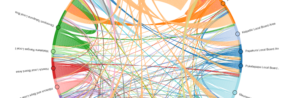
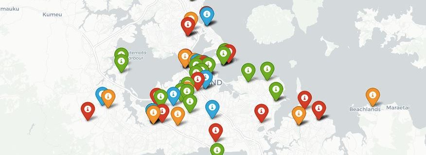
Urban transport systems are complex, dynamic, and deeply human. To plan them effectively, we need models that capture how people actually move, not just how traffic flows. Over the past few months, I’ve been building such a model for Wellington using MATSim, an open-source Agent-Based Model (ABM) platform designed for large-scale transport simulation. This work …
Read more “From Data to Decisions: Building an Agent-Based Transport Model for Wellington”